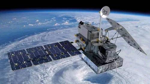
The USA has put into space the world's most advanced and powerful weather satellite. Scientists say it will revolutionize how we predict the weather and how we look at weather events. The National Oceanic and Atmospheric Administration (NOAA) said its $1 billion Geostationary Operational Environmental Satellite (GOES-R) will take weather photographs five times faster than other satellites, and with four times higher image quality. The NOAA said: "Without a doubt, GOES-R will revolutionize weather forecasting as we know it." A weather forecaster said the difference in the speed and quality of the satellite's images is like the difference between old black and white TV pictures and today's HD televisions.

The new satellite will give us powerful, real-time images and information. These will make the world a safer place. Airline pilots will receive better data to stay away from turbulence. The satellite will be able to zoom in on severe weather events to get much more detailed and accurate pictures. This will help emergency services to warn people more quickly and reduce the costs to human life and property. People will have better information about hurricanes, tornadoes, flooding, volcanic ash clouds, and wildfires. A scientist at the NOAA said: "It will give the weather as it's looking now rather than the weather that happened 15 to 30 minutes ago." The NOAA said weather forecasters couldn't wait to use it.
译文由可可原创,仅供学习交流使用,未经许可请勿转载。


